The short version
Winter is when the Gorge waterfalls run loudest and the roads are least predictable. You don’t need a Multnomah Falls permit (the 2026 season ended September 7). Check TripCheck for ice the morning you drive, carry microspikes December through February, and keep the day to four short waterfalls: Latourell, Wahkeena, Multnomah and Wahclella.
- Permit. None needed in winter; the 2026 Multnomah timed-use season ran May 22 to Sept 7
- Vista House. Fridays to Mondays, 10 a.m. to 4 p.m., Oct 30 to Mar 21, weather permitting
- Parking. $10 state park fee at Crown Point and Latourell ($12 out of state); $5 at Wahclella
- Closed. Oneonta Gorge and the Eagle Creek fire closure trails; Multnomah Lodge restrooms through November
The Columbia River Gorge in winter is the best version of the Gorge and the worst version to improvise. This is what is open, what is closed, and the four waterfalls worth your short winter daylight.

Winter Is When the Water Is Loudest
Start with why anybody drives out here in December at all. There are more than 90 waterfalls on the Oregon side of the Gorge alone, and the western end, where nearly all of them are, takes about 100 inches of precipitation a year. Eighty miles east that number is 10. The waterfall corridor exists because of the weather people come here to avoid.
So the falls that look thin and polite in an August photo are a different animal after a wet week in December. Louder, wider, throwing spray far enough back that you feel it before you see it. Multnomah Falls drops 620 feet in two tiers, 542 feet in the upper and 69 in the lower, and it is fed year round by underground springs off Larch Mountain, so it never actually quits. In winter the rain piles on top of the springs and it shows.
The other half of the case is the parking lot. Multnomah Falls draws more than two million visitors a year and is the most-visited natural recreation site in the Pacific Northwest. On a wet Tuesday in December you can stand at the base of it with nine other people.
The Permit Question, Answered in One Line
You do not need one.
The Multnomah Falls timed entry permit applies to the I-84 exit 31 parking lot from May 22 through September 7 in 2026, between 9 am and 6 pm daily, at a $2 transaction fee through Recreation.gov. Outside those dates and outside those hours, no reservation exists to make. December is wide open.
Parking notes that still apply in winter. The exit 31 lot off I-84 is a large free public lot and the Forest Service says the entrance closes automatically once it fills. The small lot on the Historic Highway in front of Multnomah Falls Lodge is limited accessible parking, privately operated, with a fee. The lodge restrooms are closed for renovation through November 2026 with portable toilets on site, so plan a stop in Troutdale on the way out.
What Is Actually Closed, and Where to Look It Up
This is where a winter Gorge trip goes wrong, and it is not the weather’s fault. People plan around a 2019 blog post. Here is what the Forest Service lists.
- The Eagle Creek Fire Area closure is still on. Forest Order 06-22-01-26-04 closes Ruckel Creek Trail #405 and Tanner Butte Trail #401 and restricts the Oneonta Gorge area. If your plan involved scrambling up Oneonta, rebuild the plan. The Eagle Creek Trail to Punch Bowl Falls isn’t on the closure list.
- Multnomah Falls Lodge restrooms, closed for renovation through November 2026.
The driveable stretch of the Historic Highway closes on conditions rather than a calendar, and it can close without much notice when ice arrives. Check TripCheck.com or dial 511 the morning you drive.
Check it the morning you go, not the night before. TripCheck.com has the road conditions map and the winter travel section, or dial 511 from anywhere in Oregon. For trails, the Forest Service alerts page for the Gorge National Scenic Area is the one that gets updated, and Friends of the Columbia Gorge at 503-241-3762 track closures on their hike finder. Two minutes there saves you the drive.
Winter 2026-27 status: permits, fees and closures
- Multnomah Falls: the I-84 Exit 31 timed-use permit ran daily 9 a.m. to 6 p.m. from May 22 through September 7, 2026 and has ended for the season (ODOT, Recreation.gov).
- Multnomah Falls Lodge restrooms are closed for renovation through November 2026; portable toilets are on site (Forest Service alerts).
- Still closed after the Eagle Creek Fire (Forest Order 06-22-01-26-04): Ruckel Creek Trail #405, Tanner Butte Trail #401 north of Tanner Cutoff Trail #448, and the inside of Oneonta Gorge (Forest Service alerts).
- Vista House: Fridays to Mondays, 10 a.m. to 4 p.m., October 30, 2026 to March 21, 2027, closed when winds top 50 mph or in bad weather; a day-use parking permit is required and the lot is open 6 a.m. to 9 p.m. (Oregon State Parks).
- State park parking: Latourell Falls joined the day-use parking fee on March 30, 2026, at $10 for Oregon residents and $12 for out-of-state visitors, free if you walk, bike or ride transit (Oregon State Parks).
- Wahclella Falls Trailhead: $5 per vehicle per day or a valid pass; no cash or checks at the trailhead, so buy ahead or pay by QR code there (Forest Service).
- Roads: check TripCheck or dial 511 the morning you drive.
Checked September 27, 2026. More Gorge: the Gorge fall foliage drive and Portland in December.
Ice Is the Real Variable, Not Rain
Anyone can hike in rain. Nobody hikes on a glaze, and the Gorge makes glaze better than almost anywhere.
The mechanism is the shape of the place. In winter, very cold air pours west through the Gorge from the high desert toward the mouth at the west end, which is exactly where the waterfall corridor sits. When milder wet air comes off the coast and rides over that cold layer, the rain falls through freezing air and lands as ice. That is the setup for the snow and ice storms this canyon is known for, and why the pavement at Multnomah can be a skating rink on a day Portland is only wet.
Two practical consequences. Put microspikes in the car from December through February. They cost less than a tank of gas and they are the difference between a walk and a fall. And respect the closures around the falls themselves. Rock and ice do come off these cliffs. A falling rock damaged the walkway and the concrete railing on Benson Bridge on January 9, 2014, and back on Labor Day 1995 a 400-ton boulder dropped 225 feet and injured twenty people standing on that same bridge. When they rope something off here, there is a reason.

The Four I Send People To in December
Not a comprehensive list. A short one that works when the days are eight hours long and half the trails are questionable.
Latourell Falls
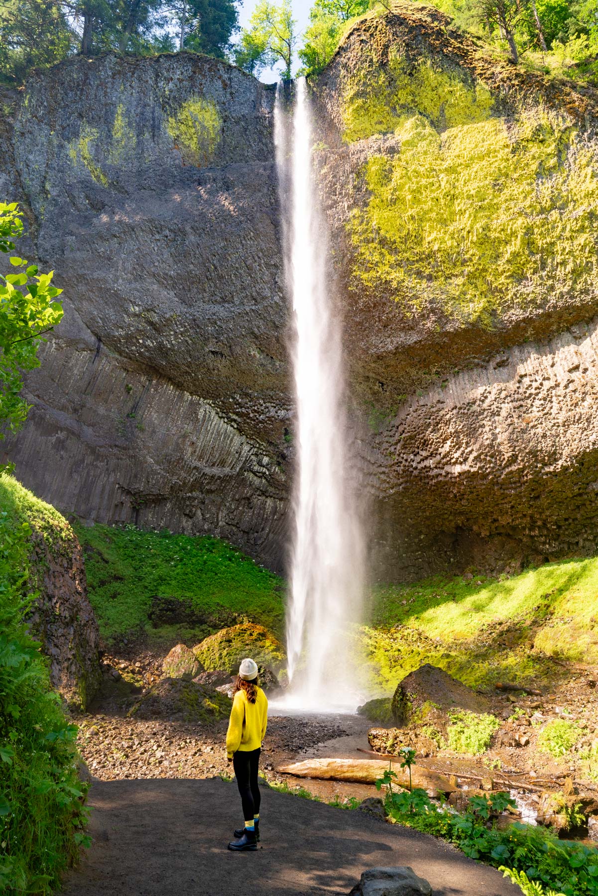
Start here, not at Multnomah. Latourell drops 249 feet in one clean plunge over columnar basalt in Guy W. Talbot State Park, the parking lot sits at the base, and the walk to a full view is short enough to do in bad shoes without consequence. Not that I am recommending that. Those basalt columns are the best exposed example in the corridor, and in flat winter light the yellow lichen on that wall is absurd. A 2.1-mile loop climbs to the upper falls if the tread looks safe.
Wahkeena Falls
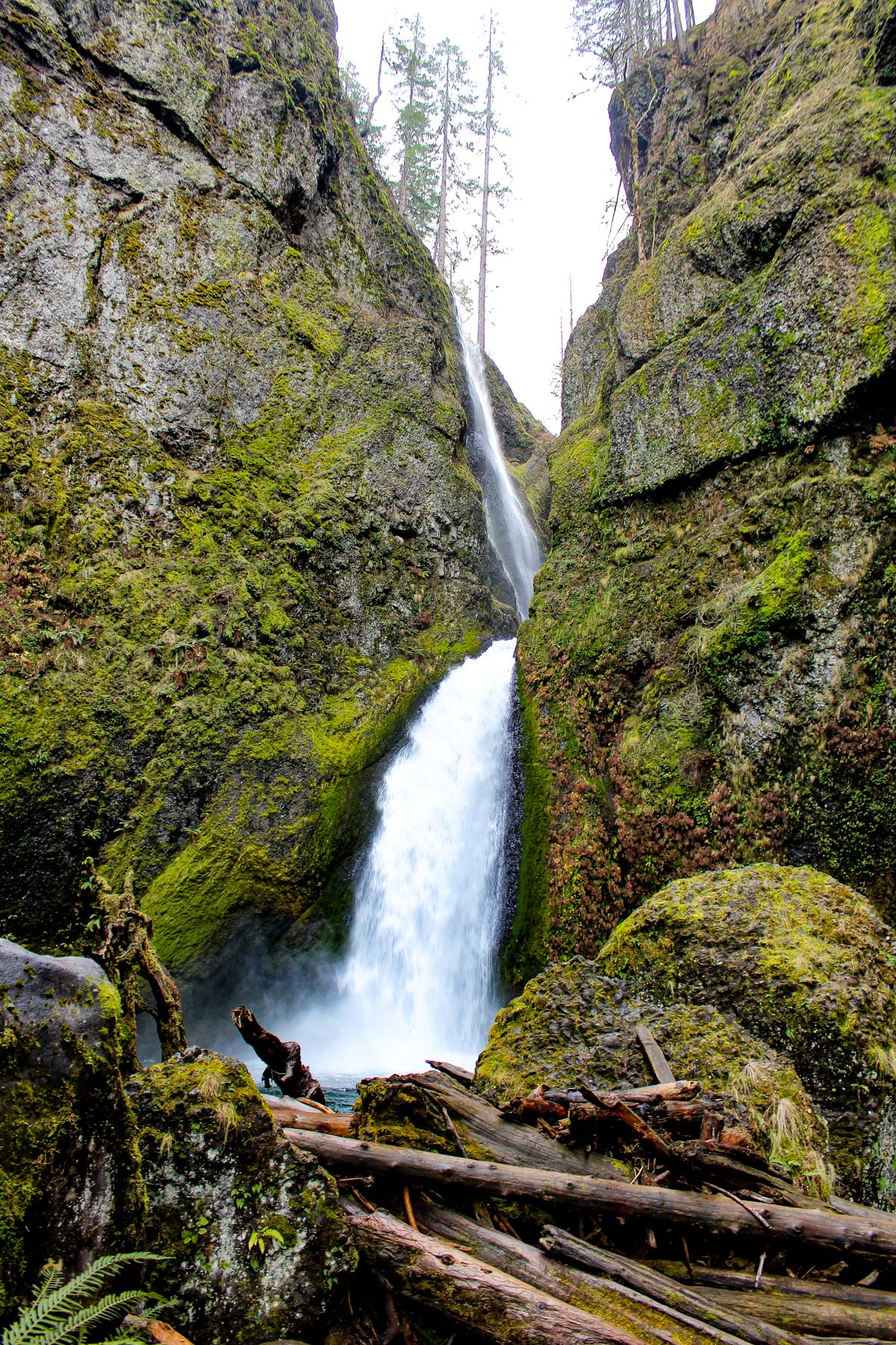
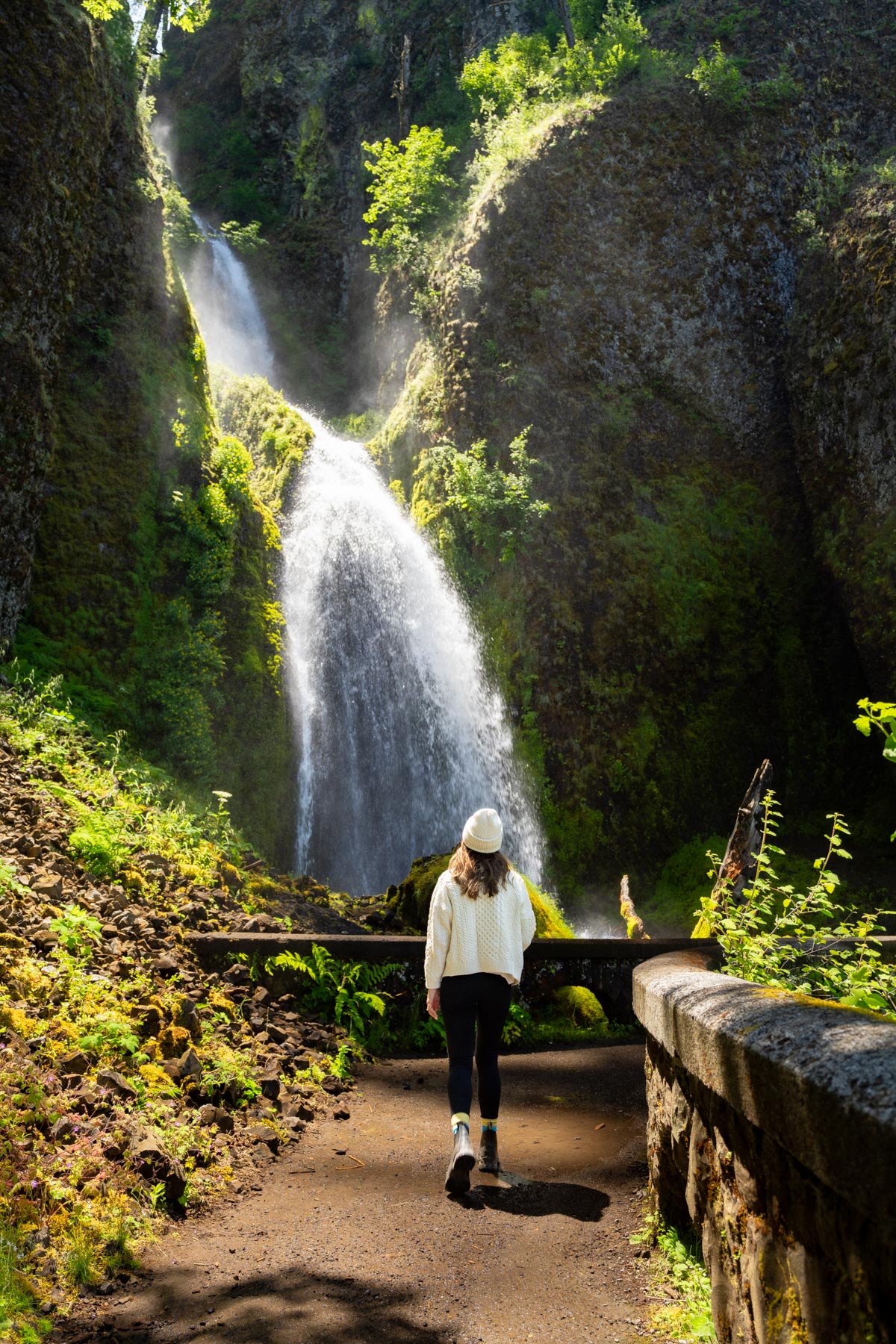
Wahkeena is 242 feet over six drops, about 13 miles east of Troutdale, and visible from the road. It is 0.2 miles from the parking area to the stone bridge at the base, the shortest real payoff in the Gorge. The name is reported from Yakama and means most beautiful, a bold claim in a canyon with 90 waterfalls, and I do not think it is wrong.
Multnomah Falls
Obviously. Go anyway, and go in the morning. Benson Bridge sits 105 feet above the lower falls, about ten minutes up from the lodge. If the trail is open and dry, Larch Mountain Trail #441 climbs to the top of the falls and back in 2.4 miles. In an icy week, do not. My full Multnomah Falls day trip guide is there if this is the only stop you are making.
Wahclella Falls
My favorite of the four and the one out-of-towners have never heard of. Trail #436 runs 1.8 miles round trip from a lot near I-84 exit 40 by Bonneville Dam and delivers you into a mossy basalt slot under 350 feet of waterfall in two tiers, the lower one about 60 feet and fully visible. The winter argument is that Tanner Creek is fed mostly by an underground spring, so the flow does not swing with the weather. The Forest Service charges a fee or requires a pass at the trailhead. My roundup of waterfall hikes near Multnomah Falls covers the rest of the corridor.
Two more if the daylight holds. Elowah Falls in the John B. Yeon State Scenic Corridor is 213 feet into a mossy amphitheater and gets a fraction of the traffic. Horsetail Falls is 176 feet and sits right beside the Historic Highway, the one you can see without leaving the car, which matters more than you think when the weather turns.
Vista House Might Be Closed When You Get There
Crown Point is the postcard and it is on the way, so people build it into the plan and find the doors locked. From October 30, 2026 to March 21, 2027, Vista House is open Fridays through Mondays from 10 am to 4 pm, weather permitting, and that last phrase does a lot of work up there. It closes for extreme cold, dangerous road conditions and winds over 50 miles an hour, which on Crown Point in December is not rare.
Call 503-344-1368 before you count on going inside. An Oregon State Parks parking permit is required. And the viewpoint itself is worth the pullout even when the building is shut, because you came to look at what the river is doing below you, not at a rotunda.
Worth knowing while you are on it. The Historic Columbia River Highway was built between 1913 and 1922 as the first planned scenic highway in the United States and became a National Historic Landmark in 2000. Of its original 75 miles, only 40 are still open to cars, the 24 westernmost from Troutdale through the waterfalls and 16 more into The Dalles. It was designed at the speed of a Model T, which is roughly the speed to take it in the wet anyway.
What I Would Not Bother With
Do not build a trip around seeing the falls frozen. It happens, it is spectacular, and it happens on a handful of days a year nobody can predict. Multnomah runs on spring water. Locking it up takes a sustained hard freeze, and a sustained hard freeze also closes the road you would drive to see it. Go for the volume. The volume is guaranteed.
Do not plan on Oneonta Gorge or anything in the Eagle Creek fire closure. The orders are real, they have been in place for a while, and the fine is not the point. Crews are still pulling that drainage back together.
And do not attempt the full corridor plus Hood River in one December day. The math is unforgiving. Sunset in late December is around 4:30, the canyon walls take the light before that, and every stop is slower in the wet. Four waterfalls is a good day. Six is a highlight reel you will not remember. For the highway end to end, go in October, which is what my Gorge foliage drive is built for.

The Whole Trip in One Paragraph
Leave Portland by nine. TripCheck first, Forest Service alerts second. Microspikes in the trunk, waterproof everything, a thermos because nothing out there is open. Latourell, then Wahkeena, then Multnomah, then Wahclella if the light holds. Home by five with wet hair and a better opinion of December than you left with.
The Columbia River Gorge in winter is the best version of the Gorge and the worst version to improvise. Do the fifteen minutes of homework and it is the most beautiful drive in Oregon with nobody on it. Skip the homework and you will run out of daylight at waterfall number two. For the wider picture of the canyon and what runs in every other season, my Columbia River Gorge guide covers the rest, and if you are building a whole December around this, Portland in December has the city half of the plan.
Until next time,
Antonina
No. The Multnomah Falls timed entry permit only applies to the I-84 exit 31 lot from May 22 through September 7 in 2026, 9 am to 6 pm daily, at a $2 transaction fee on Recreation.gov. In December there is no reservation to make and the exit 31 lot is free.
The driveable stretch closes on conditions rather than a fixed calendar, and it can close fast when ice moves in. Check the road conditions map on TripCheck.com or dial 511 the morning you drive, not the night before.
The Forest Service’s Eagle Creek Fire Area closure covers Ruckel Creek Trail #405, Tanner Butte Trail #401 and the Oneonta Gorge area. Check the Gorge National Scenic Area alerts page before you go.
Occasionally, on a handful of unpredictable days. Multnomah Falls is fed year round by underground springs off Larch Mountain, so it takes a sustained hard freeze to lock it up, and that same freeze usually closes the road you would drive to see it. Come for the winter volume instead, which is reliable.
Wahclella Falls. Trail #436 runs 1.8 miles round trip from a lot near I-84 exit 40 by Bonneville Dam, and it ends in a mossy basalt slot under 350 feet of waterfall. Tanner Creek is spring fed, so the flow stays strong. The Forest Service charges a fee or requires a pass at the trailhead.
Newest on Columbia Gorge & Hood River
- Columbia River Gorge Fall Foliage Drive Sep 2026
- Hood River Fruit Loop: A Local’s Fall Guide Aug 2026
- Hood River Weekend Guide (2 Days of Food, Wine, and Gorge Views) Jun 2026
- Best Restaurants in Hood River, Oregon (Where Locals Actually Eat) May 2026
- The Best Waterfalls Near Multnomah Falls (10 Falls Most Tourists Miss) Apr 2026
- Best Restaurants Near Multnomah Falls (Where to Eat in the Gorge) Apr 2026