The Historic Columbia River Highway is my favorite road in Oregon, and I say that as someone who has driven most of them. My husband and I run it in every season, and I keep coming back to one truth. October is when the old highway earns its reputation. The waterfalls are still running, the crowds thin out after Labor Day, and the bigleaf maples and cottonwoods light up the whole corridor in yellow and rust and copper.
Here is the thing most people get wrong. They treat this drive as a race to Multnomah Falls, snap a photo, and turn around. The real magic lives in the pull-offs between the famous stops. The stone-walled viewpoints. The little gravel turnouts that photographers pretend not to know about. I am going to walk you through the whole route, roughly west to east, mile by mile, and tell you where to actually pull over.
One thing to make peace with first. This is a slow road by design. Do not attempt to do it in a hurry.

When the Gorge Actually Peaks (and Why Timing Matters)
Fall color in the Columbia River Gorge runs from late September through about the third week of October, with the exact peak sliding a week or two either way depending on the weather. A wet, cool early fall pushes it later. A dry warm stretch brings it on fast and drops the leaves quicker. If I had to circle one window on a calendar, I would say the second and third weeks of October are your safest bet for the western waterfall corridor.
The eastern end of the drive, out past Hood River toward Mosier and Rowena, turns earlier because the Oregon white oaks and the drier climate get there first. So if you go in early October, weight your day toward the east. If you go late, stay west with the maples. I track how the color moves week by week across the region in my guide to when Oregon’s leaves change, which is worth a look before you commit to a date.
One logistics note that will save your whole morning. The Multnomah Falls timed-use permit, the one everyone panics about, only runs from late May through the first week of September. By the time the leaves turn, it is gone. You can just show up. That alone is a good argument for a fall visit over a summer one.
Mile 0. Start at Portland Women’s Forum, Not Vista House
Everyone points their car at the Vista House. I am going to tell you to stop one viewpoint short of it first, at the Portland Women’s Forum State Scenic Viewpoint, also called Chanticleer Point. This is the turnout locals actually shoot from.
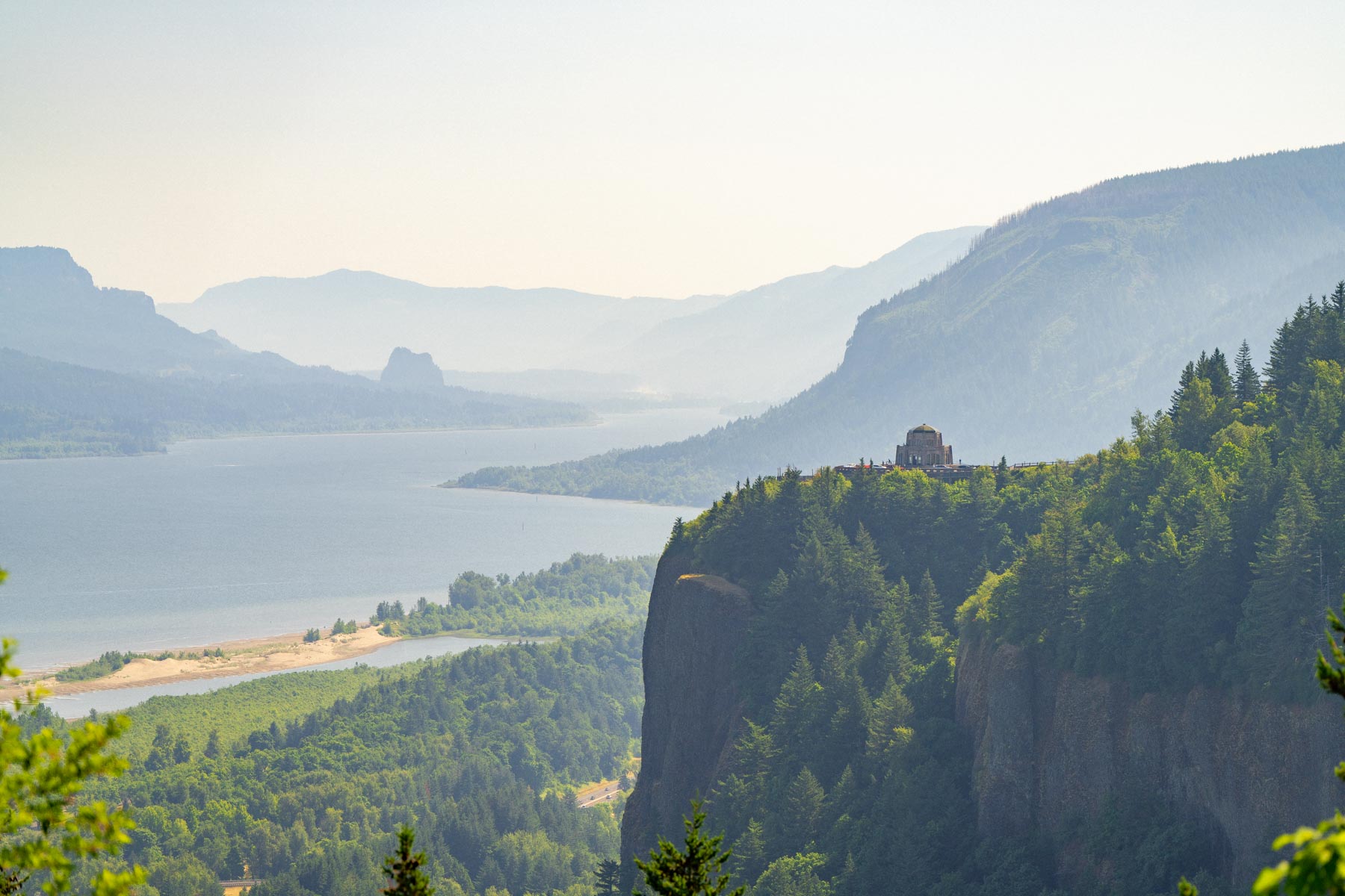
Here is why. From Chanticleer Point you get the classic photo of the Vista House itself, that little stone rotunda perched on the cliff, framed by the whole sweep of the Gorge behind it. You cannot get that shot from the Vista House because you are standing on it. Come at sunrise if you can manage it. The light rakes down the river and the fog often pools in the low spots below you. And it is free, no parking fee, which is increasingly rare out here.
Mile 2. Vista House at Crown Point
Now drive the two curving miles to the Vista House at Crown Point. It sits 733 feet above the Columbia, and it is exactly as dramatic as it sounds. The building itself is a 1918 stone observatory with a small gallery, gift items, and an espresso bar, and the view from the parapet looks straight down the throat of the Gorge.
A couple of honest heads-ups. The Vista House closes whenever winds hit 50 miles an hour or more, which on that exposed point is not rare, so check before you count on it being open. In 2026 the interior keeps limited hours, Friday through Monday, 10 a.m. to 5 p.m., so a Tuesday sunrise visitor will be admiring it from outside. And as of October 2025 there is now an Oregon State Parks day-use parking fee here, ten dollars for Oregon plates and twelve for out-of-state, or free if you walk or bike in. Admission inside the building itself is still free.
The move? Go early. The parking lot is small and it fills. If it is packed and windy, do not fight it. You already got your best photo back at Chanticleer.
Mile 3. The Figure-Eight Loops Below Crown Point
This is one my husband and I keep to ourselves. Right after the Vista House, the old highway drops off the point in a set of tight, banked switchbacks, and there is a small pullout partway down where you can look back up at the loops stacking against the cliff with the maples going gold in the folds of the hillside. It is not signed. It is just a wide spot in the road. But in mid-October, with the light behind you, it is one of the prettiest fifty feet of pavement in the state. Pull over carefully, because people take these curves faster than they should.
Mile 5. Latourell Falls
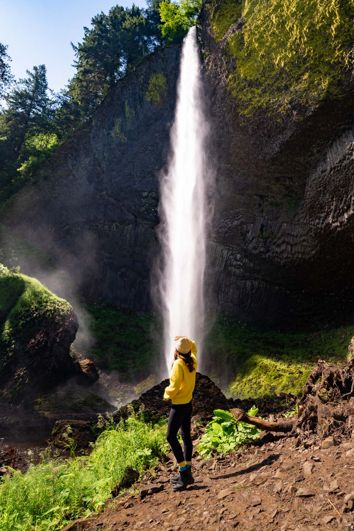
Latourell is the first of the big waterfalls, and it is criminally underrated because it comes before the famous ones. It drops 249 feet in a single clean plunge against a wall of columnar basalt, the kind that looks like someone stacked a thousand black crayons on end. The lower falls is a two-minute walk from the lot. No excuses.
What makes Latourell a fall standout is the bright yellow-green lichen splashed across that black rock. Against autumn foliage it is almost gaudy, in the best way. Bring a tripod if you have one and go for a slow shutter to smooth the water.
The catch. Latourell sits in Guy Talbot State Park, and as of March 2026 it now charges the Oregon State Parks day-use parking fee, ten dollars for Oregon plates and twelve for out-of-state. If you would rather skip the fee, you can walk or bike in for free, and honestly the highway between here and Bridal Veil is a gorgeous stretch to pedal.
Mile 6. Shepperd’s Dell and Bridal Veil
Two quick ones back to back. Shepperd’s Dell is easy to blow right past. It is a stone-arched bridge over a mossy grotto, and there is a short paved path down to a viewpoint of the falls tucked into the canyon. Ninety seconds of walking for a genuinely lovely, quiet spot most people never bother with.

A mile on is Bridal Veil Falls. The falls themselves take a half-mile round-trip walk down, a two-tiered ribbon of water, but the sleeper here is the upper trail loop out to the cliff overlook. In fall the meadow and the oaks up top go golden and you can see clear across the river to Washington. Bridal Veil also now carries the state parks day-use fee, so plan on paying or plan on walking.
Mile 8. Wahkeena and the Turnout Between the Two Giants
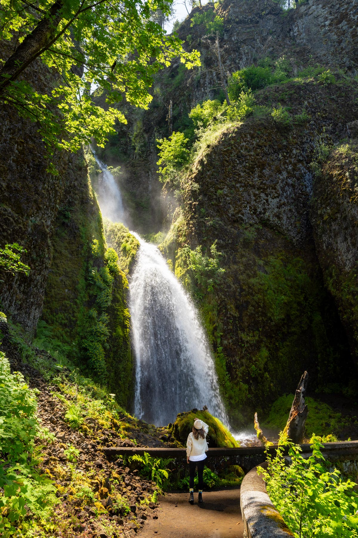
Wahkeena Falls is a 242-foot cascade that tumbles and weaves down the mountainside rather than free-falling, so it photographs completely differently from Latourell. There is a stone footbridge partway up the short trail that is the shot everyone wants and almost nobody gets, because they are already thinking about Multnomah Falls half a mile up the road.
And that half mile is my quietest secret. There is a footpath connecting Wahkeena to Multnomah, and if you park at Wahkeena and walk it, you approach Multnomah from the side, through the trees, with maples overhead the whole way. You skip the parking circus entirely and you earn the falls instead of just pulling into a lot. I wrote up more of these connector routes in my roundup of the best waterfalls near Multnomah Falls that most tourists miss, and this is my favorite of the bunch.
Mile 9. Multnomah Falls
The big one. Multnomah Falls drops 620 feet in two tiers, an upper plunge of 542 feet and a lower step of 69, and it is the tallest waterfall in Oregon. Yes, it is crowded. Yes, it is worth it anyway, because in October the surrounding slope of bigleaf maple frames the whole thing in gold.
Do the short switchback up to the Benson Footbridge, which spans the gap between the two tiers at 105 feet. Standing there with the upper falls thundering over your head is the moment people remember. If your legs are up for it, the full trail continues to the top, and the view back down the Gorge in fall color is worth the climb.
The Multnomah Falls Lodge at the base is open, with a restaurant and a gift shop, and it is a fine place to warm up with a coffee on a cold morning. One small heads-up for 2026: the lodge restrooms are under renovation through November, so use the ones you find elsewhere along the corridor and do not count on them here. For a fuller strategy on beating the crowds, I laid it all out in my Multnomah Falls day trip guide.
Mile 10. Horsetail Falls
Horsetail Falls is the one that hugs the road. It drops 176 feet right beside the pavement, no walking required, and it is shaped exactly like its name. Because it is so accessible, it is a great one for the end of the western leg when everyone in the car is tired of stairs. Just pull over and look.
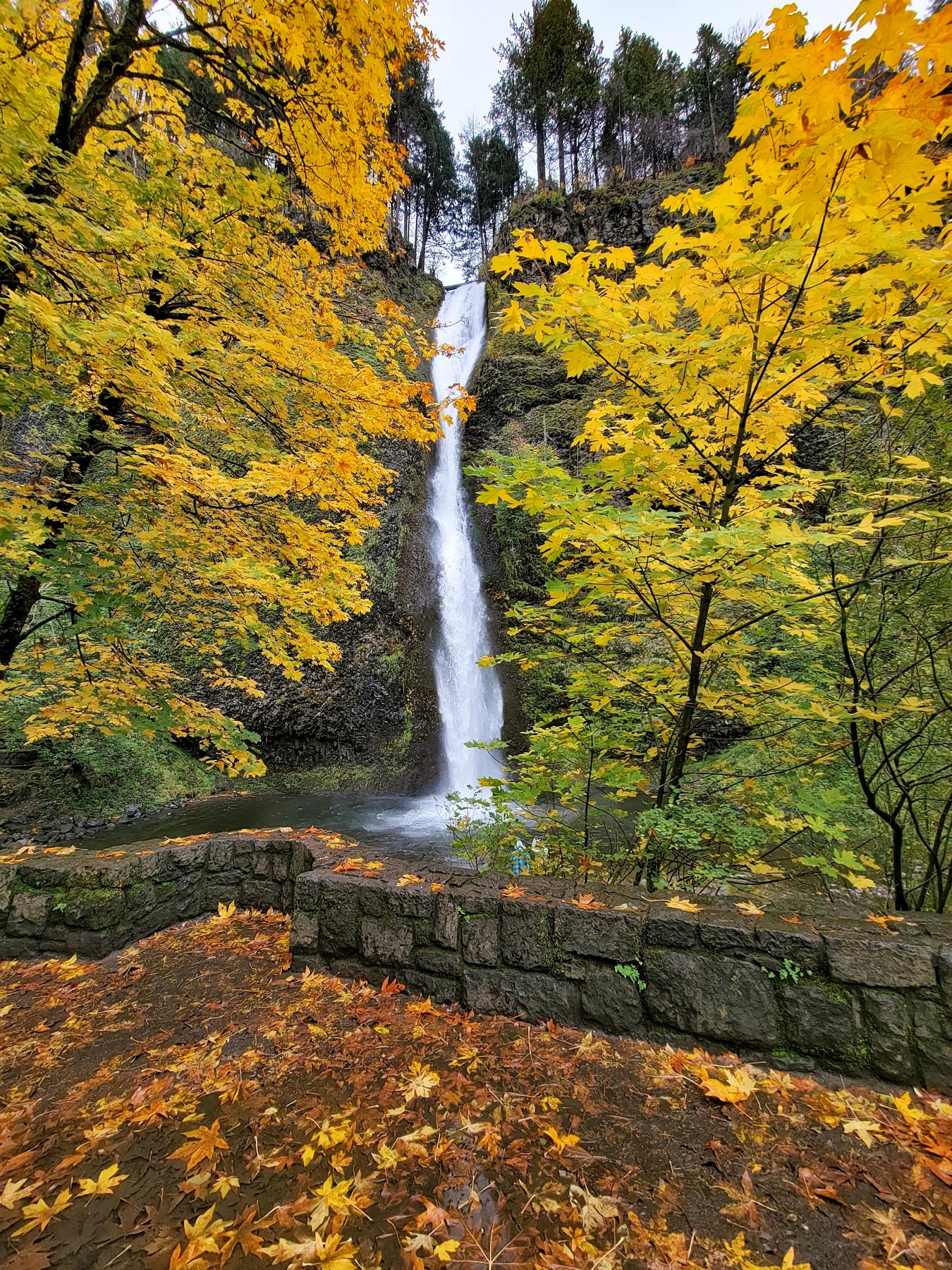
The little loop above it, up to Ponytail Falls where the trail actually goes behind the water, is a worthy add if you have the energy. In fall the mossy overhang drips onto a carpet of yellow leaves and it feels like the inside of a snow globe.
The Eastern Leg. Hood River to Rowena
Here is where most drivers turn around, and here is where I think they make their mistake. If you get back on I-84 and run east past Hood River, you can pick up the eastern segment of the Historic Highway again, and this stretch is a completely different landscape. The rainforest gives way to open oak savanna, and the color goes from maple-gold to the warm russet of Oregon white oak.
Hood River itself is a good lunch stop, a wind-sports town with a walkable downtown and good beer. My husband and I usually break the day here. If you want to make a real weekend of it, I put together a whole Hood River weekend guide with where to eat and stay.
The Grand Finale. Rowena Crest
If you only add one thing to the standard waterfall drive, make it Rowena Crest. Past Mosier, off I-84 at Exit 69, the Historic Highway climbs into a set of tight horseshoe loops carved into the plateau by Samuel Lancaster, and at the top is an overlook where you can look straight down at the highway coiling on itself against the cliff. It is the most photographed stretch of the old road for a reason.
The overlook sits at the edge of the Tom McCall Preserve at Rowena, a plateau of oak savanna and grassland protected by the Nature Conservancy. The McCall Point trail climbs from here roughly May through October, and here is where I will be straight with you. Everyone knows this spot for its spring wildflowers, and the balsamroot really is a May thing, not an October one. Do not come in fall expecting a meadow of gold. Come for the other thing. The grasses go tawny, the Oregon white oaks turn bronze across the whole plateau, and the light in the eastern Gorge in October is a color I do not have a good word for. Golden, but heavier than that.
This is the turnaround. From here it is a straight shot back to Portland on the interstate, and you will drive most of it into a sunset if you time it right.
What I’d Skip, Honestly
I promised you the honest version, so here it is. Oneonta Gorge, the narrow slot canyon between Horsetail and Multnomah, is famous and beautiful and I would skip it on a fall foliage day. The scramble over the logjam is genuinely dangerous, it is cold water, and it is not a color destination anyway. Save it for a hot August afternoon when the point is getting wet.
I would also skip trying to do the whole thing plus the eastern leg in a single short day. It is a lot of stops, a lot of parking, a lot of stairs. If you only have half a day, do Chanticleer through Multnomah and turn around. Half the road done properly beats the whole thing done in a blur.
A Few Practical Notes Before You Go
Bring layers. The Gorge makes its own weather, and the difference between a sunny Crown Point and a foggy Multnomah base can be twenty degrees. Carry a card for the state parks day-use fees at Crown Point, Latourell, and Bridal Veil, or buy a permit online ahead of time. Fill your gas tank in Troutdale before you start, because services on the old highway are thin.
And go on a weekday if you possibly can. The single biggest upgrade to this drive is not a better camera or a secret turnout. It is a Tuesday in October instead of a Saturday. For the wider context, my local’s guide to the Columbia River Gorge pairs well with this one.
The Historic Columbia River Highway was built more than a hundred years ago specifically so people could slow down and look. In October, with the maples on fire and the crowds gone home, it does exactly what it was designed to do. Take the long way. Pull over at the wide spots. That is where the good stuff is.
Frequently Asked Questions
Peak color in the Gorge typically runs from late September through the third week of October, with the exact timing shifting a week or two either way depending on the weather. The eastern end near Mosier and Rowena turns earlier because of its drier oak country, while the western waterfall corridor peaks a bit later with its bigleaf maples.
No. The Multnomah Falls timed-use permit only runs from late May through the first week of September, so from mid-September on no permit is required for the I-84 lot and you can simply show up. The broader waterfall corridor no longer requires a permit at all. That is one of the best reasons to make this drive in autumn.
Yes, at several stops. As of October 2025 Vista House at Crown Point, and as of March 2026 Latourell Falls and Bridal Veil Falls, all require an Oregon State Parks day-use parking permit, ten dollars for Oregon plates and twelve for out-of-state. Parking is free if you walk, bike, or take transit.
The Portland Women's Forum State Scenic Viewpoint, also called Chanticleer Point, is the classic spot. It sits one viewpoint west of Crown Point and frames Vista House against the full sweep of the Gorge. It is free to park and best at sunrise, when the light comes straight up the river onto the rotunda.
Plan on a full day if you want to include the eastern leg out to Rowena Crest, with time for short walks at the waterfalls and lunch in Hood River. If you only have half a day, drive from Chanticleer Point through Multnomah Falls and turn around. Start at sunrise to beat the crowds.
Until next time,
Antonina
Newest on Columbia Gorge & Hood River
- Hood River Fruit Loop: A Local’s Fall Guide Aug 2026
- Hood River Weekend Guide (2 Days of Food, Wine, and Gorge Views) Jun 2026
- Best Restaurants in Hood River, Oregon (Where Locals Actually Eat) May 2026
- The Best Waterfalls Near Multnomah Falls (10 Falls Most Tourists Miss) Apr 2026
- Best Restaurants Near Multnomah Falls (Where to Eat in the Gorge) Apr 2026
- Multnomah Falls Day Trip from Portland (How to Beat the Crowds) Apr 2026