
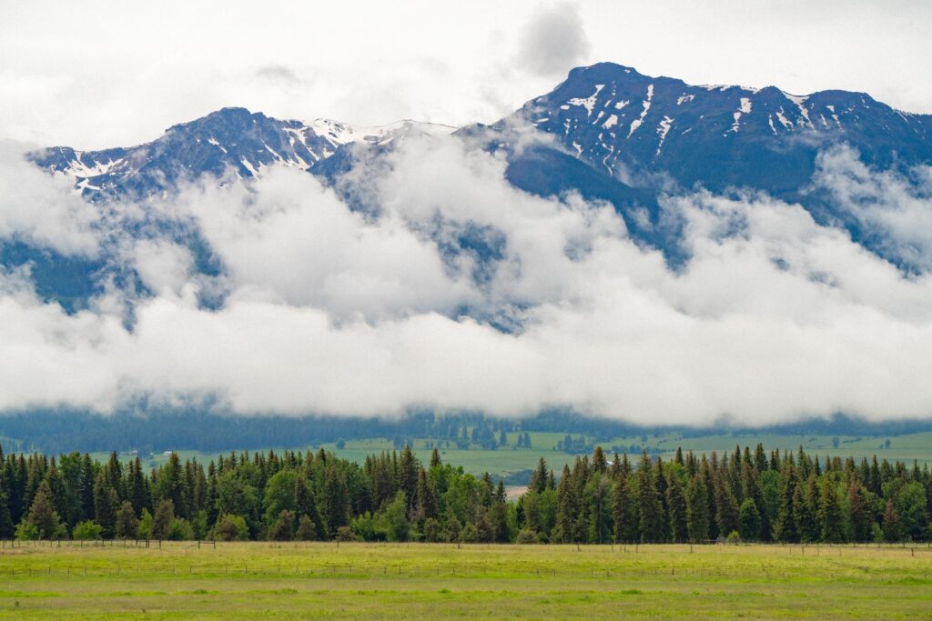
The short version
Western larch turns gold from about mid-October to early November, and it only grows on the dry east side of the Cascades and in eastern Oregon. The easiest walk is the 2.5-mile Larch Trail Loop at the Metolius Preserve near Sisters; Hurricane Creek near Joseph and Bonny Lakes in the Wallowas are the bigger days.
There is a two-week stretch in Oregon, usually the back half of October, when whole mountainsides catch fire without a single flame. The needles do it. Western larch, a conifer that flat-out refuses to act like a conifer, turns the color of a struck match and then, a couple weeks later, drops the whole show onto the trail. As a lifelong Oregonian, I can tell you it is the most underrated fall event in the state. And the most fleeting.

Here is the thing nobody warns you about. Miss the window and you get a hillside of bare gray sticks that look, honestly, a little sad. Hit it right and you get something closer to standing inside a lit lantern. The margin for error is about ten days. So let’s talk about where the larch actually grow, which trails put you shoulder-deep in them, and the one week you cannot afford to be at work.
What Western Larch Actually Is (And Why It Fools People)
Western larch, Larix occidentalis, is a deciduous conifer. Read that twice, because it sounds like a contradiction. It grows needles and cones like a fir or a pine, but every autumn those needles go gold and fall off, the way a maple sheds leaves. Come November the tree is standing there naked, looking half-dead, and it is completely fine. By June it has grown a soft new flush of green needles and started over.
Oregonians and folks from back east both call it “tamarack,” which drives botanists a little nuts, because the true tamarack is a different larch that grows in the upper Midwest and Northeast. Ours is the western larch, and it is a genuinely huge tree. Old ones can push past 150 feet with thick, fire-resistant bark the color of cinnamon.
You will not find it on the west side of the state, though, and this is where people get burned. Western larch grows on the dry, east side of the Cascades and through the mountain ranges of eastern Oregon, roughly between 3,000 and 7,000 feet. The Metolius watershed near Sisters is about the westernmost you will reliably see it. Everything from there east through the Blue Mountains ecoregion, the Ochocos, the Strawberries, the Elkhorns, and the Wallowas, is larch country. Portland and the coast get zero. So if you are hunting gold, you are driving east. Full stop.
The Window. And Why It’s So Cruel.
Larch color runs late. While the vine maples and bigleaf maples are doing their thing in early October, the larch are still stubbornly green. They tend to turn in the last week or two of October, and by early November the peak has usually blown through. The needles hang gold for maybe two weeks, then a single windy storm can strip a whole grove in an afternoon.
Elevation matters more than the calendar. The high stuff up around Anthony Lakes and the alpine basins of the Wallowas usually turns first, sometimes mid-October. The lower groves near Camp Sherman and Sisters hang on a little later. My honest advice is to plan for the last weekend of October and keep the following weekend as a backup. If you want a broader read on how the season moves across the state, I keep a running guide to when Oregon’s leaves change that I update every year.
A heads-up first. Larch timing is genuinely hard to predict from a desk. A warm, dry September pushes it late. An early cold snap pulls it early. The safest move is to check trip reports the week you want to go and be willing to shift a day or two. Gold does not wait for your calendar.
Timing check, September 27, 2026: the Deschutes Land Trust says the Metolius Preserve larch are usually gold from mid-October to early November, and Travel Oregon (updated September 23) says northeast Oregon can hold its brightest color as late as mid-November. Sources: Deschutes Land Trust, Travel Oregon.
Metolius Preserve Larch Trail Loop (The Easy One)
If you have never done this and you want the surest, gentlest introduction, start here. The Larch Trail Loop sits inside the Metolius Preserve, a chunk of land managed by the Deschutes Land Trust just outside Camp Sherman. To reach it you head 9.8 miles west of Sisters on Highway 20, turn right on Road 14 toward Camp Sherman, and follow the preserve signs to the North Trailhead off Forest Road 600, which has room for about 12 cars.
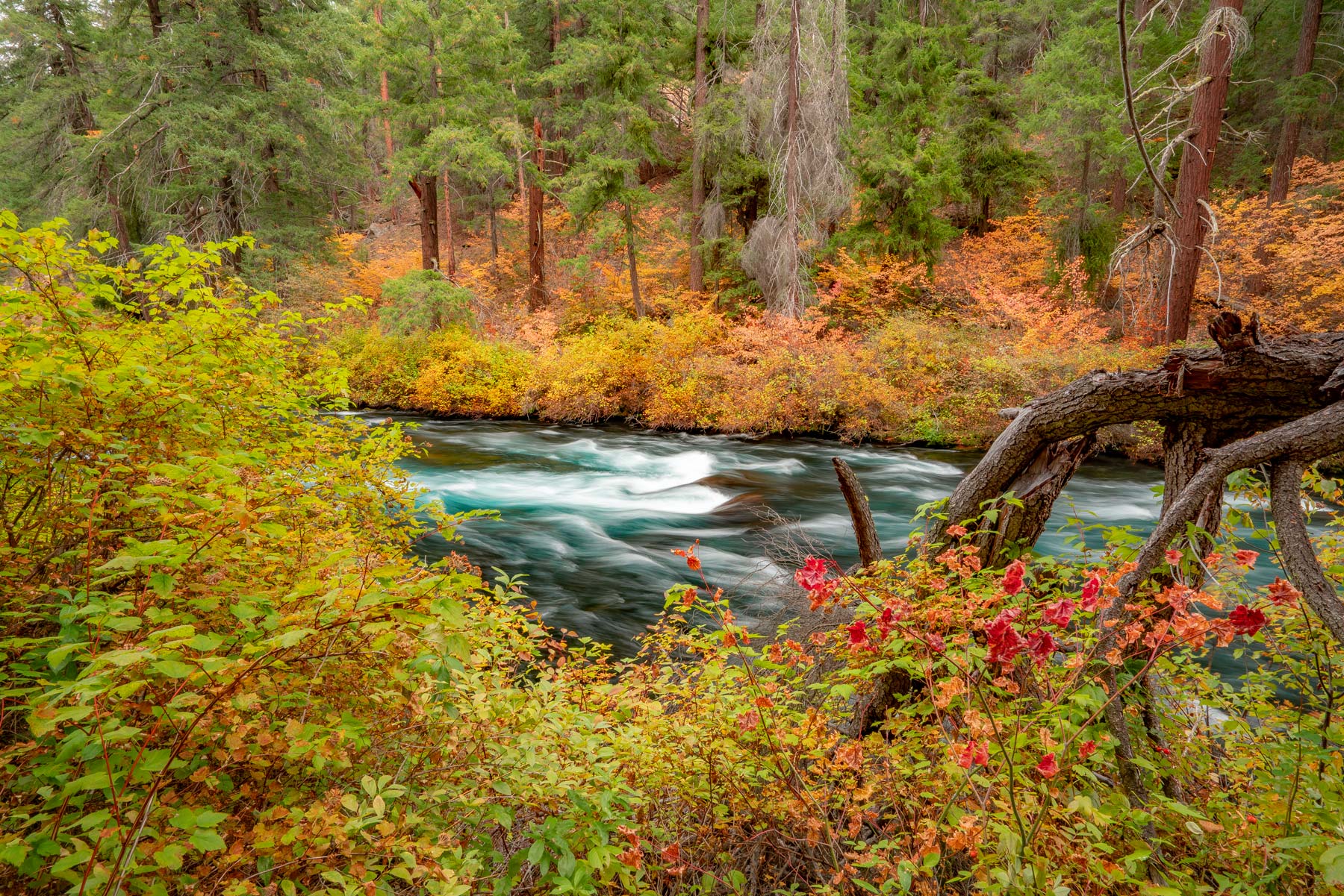
The loop runs about 2.5 miles on mostly flat trail. That is a stroll. What makes it special is that the larch hug the trail here rather than sitting off on some distant ridge, so you walk right through the gold with needles at eye level and a carpet of them underfoot. Vine maples throw in some red for contrast.
The preserve is run by a nonprofit land trust, so there is no Forest Service pass to buy for this one. Sisters is fifteen minutes away with real coffee and a bakery, which makes this an easy morning-hike-then-town afternoon. Sisters is one of my favorite small towns in the state anyway, and it lands on my list of the most beautiful places in Oregon for good reason.

Hurricane Creek, Wallowas (The Grand One)
Now for the drama. The Wallowa Mountains in the far northeast corner of the state are Oregon’s answer to the Alps, and in late October the larch band the lower slopes in yellow while the granite peaks above go bare and gray. It is a ridiculous amount of scenery for one photograph.
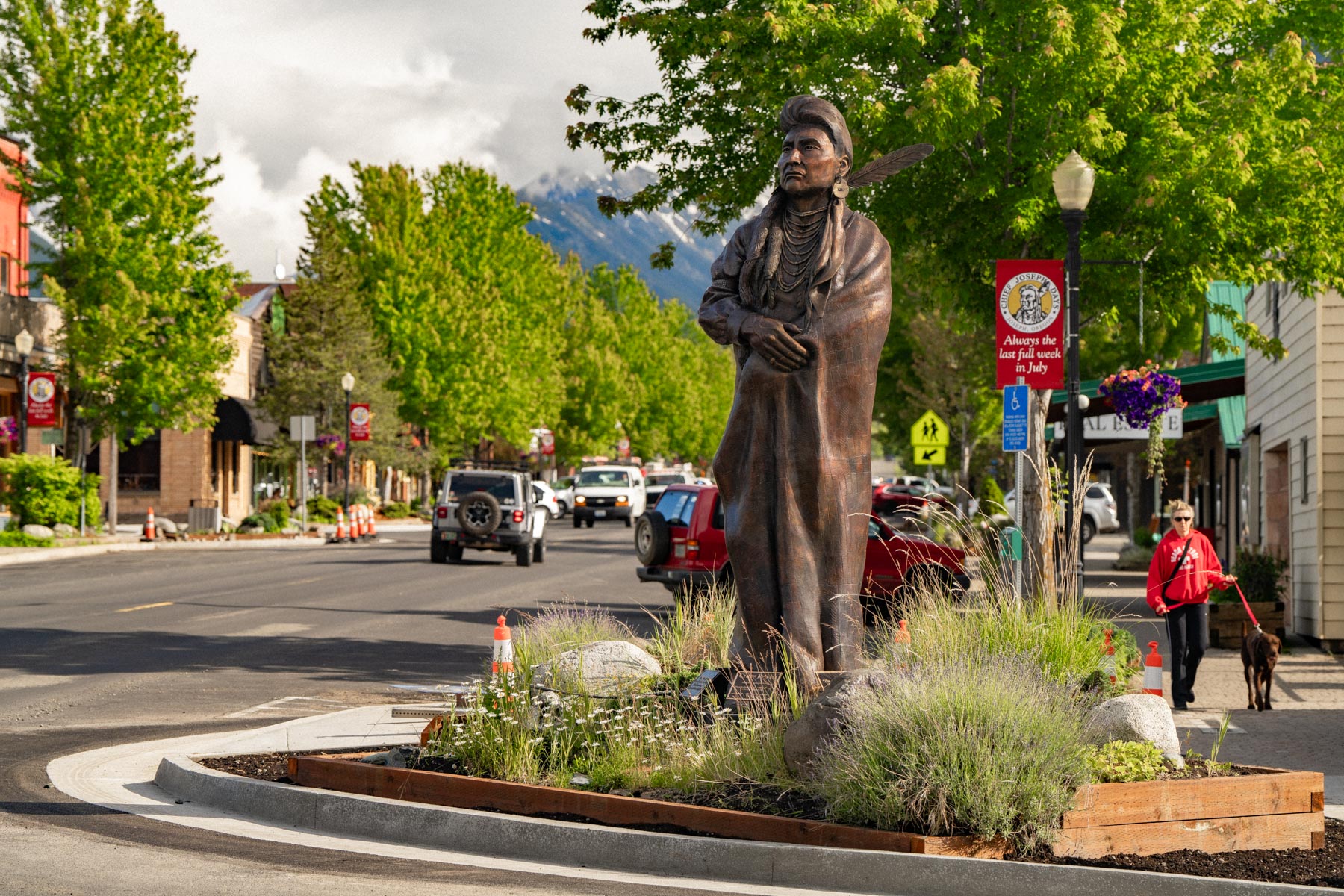
The Hurricane Creek Trail, #1807, leaves from a trailhead near Joseph and heads into the Eagle Cap Wilderness. The beauty of it is that you do not have to go far. The first mile is gentle, and within that first stretch you already have Hurricane Creek tumbling below you and Sacajawea Peak filling the sky. Day hikers often turn around where the trail crosses Slick Rock Creek, about 3.1 miles in (a little over 6 miles round trip), but even a two-mile out-and-back gives you larch and mountains. You will want a Northwest Forest Pass or the small parking fee at the trailhead, plus the free self-issue wilderness permit.
Joseph itself is worth the long drive out. Bronze foundries, a good brewery, and the deep blue of Wallowa Lake at the end of the road. If you are the type who likes to sleep near the trailhead, the region also has some of the best campgrounds in central and eastern Oregon to base out of, though check closing dates, because a lot of the high-country sites shut down by late September.
Bonny Lakes via Tenderfoot (The Alpine One)
If you want your larch reflected in a mountain pond, Bonny Lakes is the payoff. This one also sits in the Wallowas, reached from the Tenderfoot Trailhead, which starts high at around 6,500 feet. That head start means you get subalpine scenery without the brutal grind most Wallowa hikes demand.
It is about 3.5 miles in to the lower lake, where you break out of the trees into a broad meadow basin scattered with larch and, off to the east, a small stand of quaking aspen doing their own gold thing. You will need a free self-issue wilderness permit at the trailhead, which takes about ninety seconds to fill out. Go early. This is high country, and by late October a cold front can turn a bluebird morning into sideways snow by afternoon. That is not a maybe. Pack layers you would take on a summit even if the forecast looks kind.
Anthony Lakes and the Elkhorn Byway (The Scenic-Drive One)
Not everyone in your car wants to hike, and that is where the Elkhorn Mountains earn their keep. Anthony Lakes sits at about 7,100 feet in the Elkhorns west of Baker City. You reach it by taking the North Powder exit, number 285, off Interstate 84 and following the signs about 21 paved miles up Road 73.
You can walk the flat lake loop in half an hour, larch and granite the whole way, or just park and stare. The real event here is the Elkhorn Scenic Byway, a loop drive that hits peak fall color in mid-October and threads through mile after mile of larch-covered slope. It is the move for anyone who wants the gold without the sweat. One honest heads-up. The campground and some services up top close early, often by the end of September, so treat this as a day trip unless you have confirmed something is open.
Fire check, September 28, 2026: the Anthony Fire burned north of Anthony Lakes this summer, and the Forest Service closure of the burned area runs through December 31. Road 7300, the Elkhorn Scenic Byway, is open, but forest roads and trails inside the fire perimeter are closed. A second closure, around the McCully Fire north of Sumpter, shuts the Baldy Lake, Baldy Creek, Peavy and Downie Lake trails; the Elkhorn Crest Trail stays open. Sources: Wallowa-Whitman National Forest, Anthony Fire closure and McCully Fire closure.
Baker City down below makes a solid base with historic downtown blocks and easy access back to the freeway. If you are timing a broader eastern Oregon trip, my month-by-month guide to visiting Oregon lays out what else is happening in October, which is honestly one of the best months to have the state to yourself.
What to Skip. And Why.
Larch Mountain, the one an hour from Portland up the Columbia Gorge, has no western larch. None. Early loggers sold noble fir under the trade name “larch,” and the mountain kept the misleading label. It is a beautiful hike with a stunning summit view of five volcanoes, and I love it, but if you drive up there in late October expecting golden needles you will be disappointed and confused. Western larch simply does not grow that far west in the Cascades. So do that hike for the view, not the gold. For real Gorge trails worth your time, I have a whole local’s guide to Columbia River Gorge hikes, but larch is not on the menu there.
I would also gently steer you away from chasing larch on the far west or coastal side of the state entirely. People see one gold-tinged tree in a Portland park and convince themselves it is larch. It is almost certainly a planted ornamental or just a maple. The genuine article lives east. Make peace with the drive.

A Few Things Worth Knowing
Bring a real camera or at least clean your phone lens, because larch gold photographs like nothing else, especially with morning light behind it and the needles glowing. Backlight is the secret. Shoot into the sun, not with it.

Go on a weekday if you possibly can. The good larch trails near Sisters and Baker City fill up fast on peak weekends, and the Metolius parking lot is small. And pack layers for genuine cold. These are high, dry, east-side mountains, and a sunny 60-degree valley can be a 35-degree gale up top.
One last honest note. Larch season overlaps with the tail end of hunting season in a lot of eastern Oregon. Throw on something bright, keep dogs close, and you will be completely fine. It is public land shared by a lot of people, and a blaze-orange beanie costs almost nothing.
The Short Version
Drive east. Aim for the last week of October, keep the first weekend of November as backup, and watch trip reports like a hawk. Want easy and close-ish? Metolius Preserve near Sisters. Want jaw-dropping? Hurricane Creek in the Wallowas. Want alpine reflections? Bonny Lakes. Want to do it all from the driver’s seat? The Elkhorn Byway out of Baker City. And whatever you do, do not drive up Larch Mountain expecting larch.
This is my favorite two weeks of the Oregon calendar, and every single year it feels like a secret the rest of the country hasn’t figured out yet. Get out there before the wind does.
Larch Hikes in Oregon FAQ
Western larch usually peaks in the last week or two of October and can hold into early November. The high country around Anthony Lakes and the Wallowa basins tends to turn first, sometimes mid-October, while lower groves near Camp Sherman and Sisters run a little later. Plan for the last weekend of October and keep the following weekend as backup.
The easiest spot is the Larch Trail Loop at the Metolius Preserve near Camp Sherman, about 9.8 miles west of Sisters off Highway 20. It is a gentle 2.5-mile loop with larch right along the trail. Shevlin Park in Bend also has scattered larch.
No. Despite the name, Larch Mountain in the Columbia Gorge has no western larch. Early loggers used “larch” as a trade name for noble fir. Western larch grows on the dry east side of the Cascades and through eastern Oregon, not that far west.
Many trailheads, including Hurricane Creek in the Wallowas, require a Northwest Forest Pass or a small day-use fee. Wilderness trails like Bonny Lakes via the Tenderfoot Trailhead ask you to fill out a free self-issue wilderness permit at the trailhead.
Until next time,
Antonina
Newest on Nature & Hiking
- Mount Hood in Winter (Timberline, Skibowl, Sno-Parks, and Chains) Sep 2026
- Chanterelle Season in Oregon: A Beginner’s Guide Jul 2026
- Oregon Wildflower Season (When and Where to See the Best Blooms) Apr 2026
- Silver Falls Day Trip from Portland Apr 2026
- Mt. Hood Day Trip from Portland (The Complete Guide) Apr 2026
- Crater Lake Guide (Everything You Need to Know Before You Go) Apr 2026
Leave a Reply